|
||||||||||
| PREV CLASS NEXT CLASS | FRAMES NO FRAMES | |||||||||
| SUMMARY: NESTED | FIELD | CONSTR | METHOD | DETAIL: FIELD | CONSTR | METHOD | |||||||||

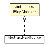
public interface IFlagChecker
Interface for the map sources. Provides access to map features and tracing methods.
| Method Summary | |
|---|---|
boolean |
hasEnemyTerritoryFlag(double x,
                      double y,
                      int enemyId)
Returns true if the given location is a valid territory for the given teamId. |
boolean |
hasEnemyTerritoryFlag(double x,
                      double y,
                      int enemyId,
                      boolean seaArea)
|
boolean |
hasEnemyTerritoryFlag(Location location,
                      int enemyId)
Returns true if the given location is a valid territory for the given teamId. |
boolean |
hasEnemyTerritoryFlag(Location location,
                      int enemyId,
                      boolean seaArea)
Returns true if the given location is a valid territory for the given teamId. |
boolean |
hasFlag(double x,
        double y,
        BasicFlag flag)
Returns true if the flag is present on the given location. |
boolean |
hasFlag(Location location,
        BasicFlag flag)
Returns true if the flag is present on the given location. |
DefConLocation |
traceFromTo(DefConLocation start,
            DefConLocation end,
            BasicFlag flag)
Returns the closest position to end from start, which has the proper flag. |
DefConLocation |
traceFromTo(DefConLocation start,
            DefConLocation end,
            BasicFlag flag,
            double distance)
Returns the a position on line to end from start, which has the proper flag and is as far as possible, while closer than distance from the closest position. |
| Method Detail |
|---|
boolean hasFlag(Location location,
                BasicFlag flag)
location - flag -
boolean hasFlag(double x,
                double y,
                BasicFlag flag)
x - y - flag -
boolean hasEnemyTerritoryFlag(Location location,
                              int enemyId)
location - enemyId -
boolean hasEnemyTerritoryFlag(double x,
                              double y,
                              int enemyId)
x - y - enemyId -
boolean hasEnemyTerritoryFlag(Location location,
                              int enemyId,
                              boolean seaArea)
location - enemyId - seaArea - if true then checks, whether [x, y] is a sea territory
boolean hasEnemyTerritoryFlag(double x,
                              double y,
                              int enemyId,
                              boolean seaArea)
DefConLocation traceFromTo(DefConLocation start,
                           DefConLocation end,
                           BasicFlag flag)
start - end - flag -
DefConLocation traceFromTo(DefConLocation start,
                           DefConLocation end,
                           BasicFlag flag,
                           double distance)
start - end - flag - distance -
|
||||||||||
| PREV CLASS NEXT CLASS | FRAMES NO FRAMES | |||||||||
| SUMMARY: NESTED | FIELD | CONSTR | METHOD | DETAIL: FIELD | CONSTR | METHOD | |||||||||