|
||||||||||
| PREV CLASS NEXT CLASS | FRAMES NO FRAMES | |||||||||
| SUMMARY: NESTED | FIELD | CONSTR | METHOD | DETAIL: FIELD | CONSTR | METHOD | |||||||||
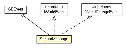
java.lang.Objectcz.cuni.amis.pogamut.base.communication.messages.InfoMessage
public class SensorMessage
Sensor messages contain the sensor data. Sensor message Every sensor message starts with “SEN”. After it is an optional Time segment, {Time float}, that reports the current time in seconds in the virtual world. Whether the Time segment will appear or not is decided by the sensor’s �?bWithTimeStamp’ variable. For details information, please read section 10 in USARSim manual v3.1.3. Please note that the Sensor message parameters depend on the type of sensor that the information is being reported. Corresponding GameBots message is SEN.
| Field Summary | |
|---|---|
protected cz.cuni.amis.pogamut.base3d.worldview.object.Velocity |
Acceleration
|
protected double |
Corona
|
protected double |
Density
|
protected double |
Dist
|
protected double |
Duration
|
protected Map<String,Integer> |
EncoderTicks
|
protected int |
Fix
|
protected double |
FOV
|
protected String |
Gas
|
protected List<Integer> |
IDs
|
protected List<Double> |
LaserRanges
|
protected Latitude |
Latitude
|
protected List<cz.cuni.amis.pogamut.base3d.worldview.object.Location> |
Locations
|
protected Longitude |
Longitude
|
protected double |
Loudness
|
protected String |
Name
|
protected OdometryPose |
OdoPose
|
protected List<cz.cuni.amis.pogamut.base3d.worldview.object.Rotation> |
Orientations
|
protected List<String> |
PartNames
|
protected javax.vecmath.Point2d |
Pos2D
|
protected cz.cuni.amis.pogamut.base3d.worldview.object.Location |
Pos3D
|
protected javax.vecmath.Point4d |
Position
|
protected double |
Prob
|
static String |
PROTOTYPE
Example how the message looks like - used during parser tests. |
protected double |
Radius
|
protected Map<String,Double> |
RangeRanges
|
protected double |
Resolution
|
protected int |
Satellites
|
protected String |
Status
|
protected double |
Time
|
protected Map<String,Boolean> |
Touches
|
protected String |
Type
|
protected javax.vecmath.Point4d |
Velocity
|
protected boolean |
Visible
|
| Constructor Summary | |
|---|---|
SensorMessage()
Used by Yylex to create empty message then to fill it's protected fields (Yylex is in the same package). |
|
SensorMessage(SensorMessage original)
Cloning constructor. |
|
SensorMessage(String Type,
              double Time,
              String Name,
              double Duration,
              double FOV,
              int Fix,
              double Loudness,
              double Prob,
              double Resolution,
              int Satellites,
              String Status,
              String Gas,
              double Density,
              boolean Visible,
              double Dist,
              double Radius,
              double Corona)
|
|
| Method Summary | |
|---|---|
void |
addRange(String Name,
         Double Range)
Used by Yylex to fill the RangeRanges Map. |
cz.cuni.amis.pogamut.base3d.worldview.object.Velocity |
getAcceleration()
Acceleration from Acceleration Sensor. |
double |
getCorona()
AIBO - ERS robot uses tracking ball sensor, that recognises a soccer ball from camera. |
double |
getDensity()
Gas sensor measures type and density. |
double |
getDistance()
AIBO - ERS robot uses tracking ball sensor, that recognises a soccer ball from camera. |
double |
getDuration()
Duration of a sound from the sound sensor. |
Map<String,Integer> |
getEncoderTicks()
String is the sensor name. |
int |
getFix()
�?int’ indicates whether or not a position was acquired. |
double |
getFOV()
FOV is the sensor’s field of view in radians. |
String |
getGas()
Gas sensor measures type and density. |
List<Integer> |
getIDs()
Used by RFID sensor. |
List<Double> |
getLaserRanges()
LaserRanges is a series of range values in meters. |
Latitude |
getLatitude()
�?int’, ’double’, ’char’ provide the latitude degree, minute (as a decimal), and cardinal description (i.e. |
List<cz.cuni.amis.pogamut.base3d.worldview.object.Location> |
getLocations()
List of Locations used by RFID sensor to determine where are various RFID Tags or by Victiom sensor to determine locations of bodys. |
Longitude |
getLongitude()
�?int’, ’float’, ’char’ provide the longitude degree, minute (as a decimal), and cardinal description (i.e. |
double |
getLoudness()
Loudnes from the sound sensor. |
String |
getName()
Name of the sensor. |
OdometryPose |
getOdoPose()
OdoPose is the estimated robot position relative to the start point in meters. |
List<cz.cuni.amis.pogamut.base3d.worldview.object.Rotation> |
getOrientations()
INS sensor entry in USARSim manual v3.1.3 suggests that it should need more than one record of Orienation, but the experience was different. |
List<String> |
getPartNames()
PartName is the name of the victim part that was discovered by the sensor. |
javax.vecmath.Point2d |
getPos2D()
AIBO - ERS robot uses tracking ball sensor, that recognises a soccer ball from camera. |
cz.cuni.amis.pogamut.base3d.worldview.object.Location |
getPos3D()
AIBO - ERS robot uses tracking ball sensor, that recognises a soccer ball from camera. |
javax.vecmath.Point4d |
getPosition()
Position of the robot measured by Tachometer. |
double |
getProb()
Prob is the probability of it’s human motion. |
double |
getRadius()
AIBO - ERS robot uses tracking ball sensor, that recognises a soccer ball from camera. |
Map<String,Double> |
getRangeRanges()
Map indexed by string is used to collect data of range sensor. |
double |
getResolution()
It is the sensor’s resolution in radians. |
int |
getSatellites()
�?int’ gives the number of satellites tracked by the GPS sensor. |
String |
getStatus()
Status is not in USARSim manual v3.1.3. |
double |
getTime()
Timestamp form the UT since server start in seconds. |
Map<String,Boolean> |
getTouches()
String is the sensor name. |
String |
getType()
Type describes the sensor type. |
javax.vecmath.Point4d |
getVelocity()
Velocity of the robot measured by Tachometer. |
boolean |
isVisible()
AIBO - ERS robot uses tracking ball sensor, that recognises a soccer ball from camera. |
String |
toHtmlString()
Gets all properties and values to create a HTML formated string; |
String |
toString()
|
| Methods inherited from class cz.cuni.amis.pogamut.usar2004.communication.messages.GBEvent |
|---|
getSimTime, getWorldEvent |
| Methods inherited from class cz.cuni.amis.pogamut.base.communication.messages.InfoMessage |
|---|
toJsonLiteral |
| Methods inherited from class java.lang.Object |
|---|
clone, equals, finalize, getClass, hashCode, notify, notifyAll, wait, wait, wait |
| Methods inherited from interface cz.cuni.amis.pogamut.base.communication.worldview.event.IWorldEvent |
|---|
getSimTime |
| Methods inherited from interface cz.cuni.amis.pogamut.base.communication.translator.event.IWorldChangeEvent |
|---|
getSimTime |
| Field Detail |
|---|
public static final String PROTOTYPE
protected String Type
protected double Time
protected String Name
protected Map<String,Double> RangeRanges
protected double Resolution
protected double FOV
protected List<Double> LaserRanges
protected OdometryPose OdoPose
protected Latitude Latitude
protected Longitude Longitude
protected int Fix
protected int Satellites
protected List<cz.cuni.amis.pogamut.base3d.worldview.object.Location> Locations
protected List<cz.cuni.amis.pogamut.base3d.worldview.object.Rotation> Orientations
protected Map<String,Integer> EncoderTicks
protected Map<String,Boolean> Touches
protected List<Integer> IDs
protected List<String> PartNames
protected String Status
protected double Prob
protected double Loudness
protected double Duration
protected javax.vecmath.Point4d Velocity
protected javax.vecmath.Point4d Position
protected cz.cuni.amis.pogamut.base3d.worldview.object.Velocity Acceleration
protected String Gas
protected double Density
protected boolean Visible
protected javax.vecmath.Point2d Pos2D
protected cz.cuni.amis.pogamut.base3d.worldview.object.Location Pos3D
protected double Radius
protected double Dist
protected double Corona
| Constructor Detail |
|---|
public SensorMessage(String Type,
                     double Time,
                     String Name,
                     double Duration,
                     double FOV,
                     int Fix,
                     double Loudness,
                     double Prob,
                     double Resolution,
                     int Satellites,
                     String Status,
                     String Gas,
                     double Density,
                     boolean Visible,
                     double Dist,
                     double Radius,
                     double Corona)
public SensorMessage(SensorMessage original)
public SensorMessage()
| Method Detail |
|---|
public String getType()
public double getTime()
public String getName()
public Map<String,Double> getRangeRanges()
public void addRange(String Name,
                     Double Range)
Name - Name of the range sensor.Range - Valued of the range sensor.public double getResolution()
public double getFOV()
public List<Double> getLaserRanges()
public OdometryPose getOdoPose()
public Latitude getLatitude()
public Longitude getLongitude()
public int getFix()
public int getSatellites()
public List<cz.cuni.amis.pogamut.base3d.worldview.object.Location> getLocations()
public List<cz.cuni.amis.pogamut.base3d.worldview.object.Rotation> getOrientations()
public Map<String,Integer> getEncoderTicks()
public Map<String,Boolean> getTouches()
public List<Integer> getIDs()
public List<String> getPartNames()
public String getStatus()
public double getProb()
public double getLoudness()
public double getDuration()
public javax.vecmath.Point4d getVelocity()
public javax.vecmath.Point4d getPosition()
public cz.cuni.amis.pogamut.base3d.worldview.object.Velocity getAcceleration()
public String getGas()
public double getDensity()
public boolean isVisible()
public javax.vecmath.Point2d getPos2D()
public cz.cuni.amis.pogamut.base3d.worldview.object.Location getPos3D()
public double getRadius()
public double getDistance()
public double getCorona()
public String toString()
toString in class cz.cuni.amis.pogamut.base.communication.messages.InfoMessagepublic String toHtmlString()
|
||||||||||
| PREV CLASS NEXT CLASS | FRAMES NO FRAMES | |||||||||
| SUMMARY: NESTED | FIELD | CONSTR | METHOD | DETAIL: FIELD | CONSTR | METHOD | |||||||||